
Rainfall is the most significant component of current climate variability in the tropics around Timor-Leste and is associated with the Monsoon, the Indian Ocean Dipole (IOD) and the El Niño. A critical question on understanding the biogeochemical cycle of mercury in Timor-Leste is “How these climate drivers play a role on atmospheric mercury deposition in this region?”
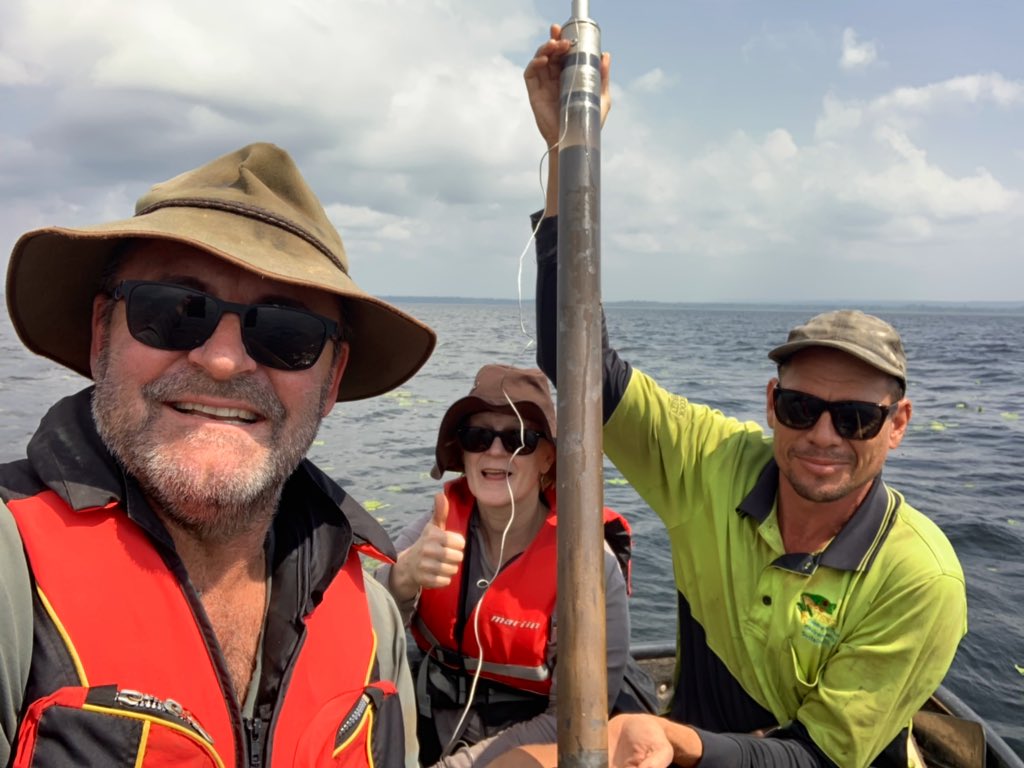
In June 2019 a group of researchers from Mercury Australia joined Timor-Leste colleagues from the Instituto do Petroleo and Geologia (IPG) to retrieve Quaternary sediment cores for palaeoclimatic and mercury studies in the lakes of Timor-Leste (Figure 1) as part of a Centre of Excellence in Biodiversity and Australian Heritage (CABAH) initiative to explore the environmental conditions that were in place since before humans first reached the eastern limits of the maritime continent before crossing the Timor Sea to Sahul over 40,000 years ago, through to the present.
One of the reasons Timor-Leste is so interesting from a palaeoclimatic point of view is that it lies at the nexus between three major climate phenomena: (i) the Indian Ocean dipole, (ii) the Asian-Australian Monsoon, and (iii) the El Nino Southern Oscillation.
In order to reconstruct the past dynamics of mercury atmospheric deposition, a multi-proxy palaeoecological/climatological approach is necessary. Sediment cores have been retrieved, for the first time, from a series of lakes located across that geographic length of Timor-Leste where a range of analyses, including, geochemistry, pollen, charcoal, diatoms, ostracods, gastropods, seeds and fungal spores will be used to identify climatic as well as human influence on landscapes of the past. Radiocarbon (14C) and Lead (210Pb) analyses will be used to date the sediments and provide a temporal scale to the sediments. Potential tephras from Indonesia may also be visible in the sediments, and if so, will be used to support the chronology of the sediment cores.
Mercury as a marker of the Anthropocene
In addition to the deep-time history of mercury atmospheric deposition in Timor-Leste, this research also aims to understand the changes in mercury deposition of the more recent past with a focus on the the Anthropocene. It is expected that mercury changes tied to two periods of transition to the Anthropocene will be identified and described: Industrialisation in the Northern Hemisphere and the Great Acceleration.
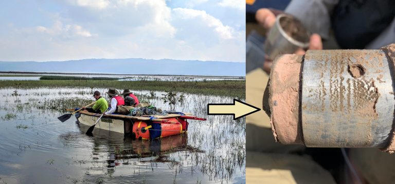
Researchers have collected cores with intriguing pink clay at 2.5 m sediment depth, suggesting very different depositional environment – potentially indicative of relatively drier last glacial period (Figure 2).
Study Sites:
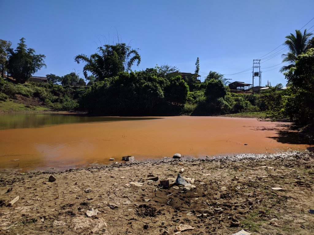
Debu Mean (Red Lake) and Debu Metan (Black Lake): these lakes were named after their water colour during the dry season (Figure 3). Chosen by their small catchment and high altitude, they are expected to be representative of atmospheric inputs and less influenced by catchment changes. This choice is especially important for geochemistry studies that need to have a true representation of atmospheric deposition, minimising catchment contribution.
The study of anthropogenic mercury changes in the last 150 years will be a focus in these two lakes, as they are ideal for obtaining a signal of atmospheric deposition of mercury. Mercury is known to have increased by 3 to 5 times with the onset of the Industrial Revolution in the Northern Hemisphere, and with the onset of the Great Acceleration in the Southern Hemisphere. As Timor is located just below the Equator, it will be interesting to see how the anthropogenic mercury from both hemispheres have impacted the natural biogeochemical cycle of mercury in Timor-Leste.
Lake Ira Lalaro: This is the largest lake in Timor-Leste and, due to its high biodiversity, it is part of the Nino Konis Santana National Park (Figure 4). At an altitude of 318 m, this lake has a water spread area of 1900 hectares which varies along the year.
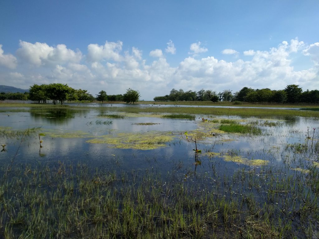
Lake Ira Lalaro is in a high plateau depression at an elevation of 334 metres formed by a huge polje karst formation, believed to have thousands of years of sedimentary record. The main objective in studying this lake is to understand the role climate plays on mercury variability in the last 100,000 years. Furthermore, researchers expect to better understand the degree of Hg atmospheric- and ocean-driven exchange between the two hemispheres.
Article by Larissa Schneider and Simon Haberle
Twitter